


Rotorheads Around the World (incl 'Views from the Cockpit')

Join Date: Mar 2008
Location: Colorado
Posts: 96
Likes: 0
Received 0 Likes
on
0 Posts
November 2013

Transitioning through the seasons...


That's all for now. I hope I haven't upset anyone by flooding this thread with pics! I haven't been posting much recently because I've been so busy but I do love to share the view. For anyone who uses Instagram, follow me @ jmc280
Make sure to go back to the previous page (275) to see pics starting in April 2013. With a few exceptions, all photos were taken on my Samsung Galaxy Note 2 cell phone with the Camera360 app, processed with the HDR "Soft" effect. I hope you all enjoy.
--JMc

JMc, always like your images, full of colour and appeal 
We're just into summer here, but the weather has held up photo shoots for weeks as we shift from rain to drizzle to sunny. Early start today, down to our $A4.5 billion (yes, billion) Desalination Plant for a much delayed early morning shoot:


They're my 'happy snaps' with the iPhone while the real photographer was happily at work!
On the way back we got a few updates around Melbourne:
Docklands


And the new roof on the Melbourne Tennis Centre; a bit strange, looking like a 1950's factory roof!

We're just into summer here, but the weather has held up photo shoots for weeks as we shift from rain to drizzle to sunny. Early start today, down to our $A4.5 billion (yes, billion) Desalination Plant for a much delayed early morning shoot:
They're my 'happy snaps' with the iPhone while the real photographer was happily at work!
On the way back we got a few updates around Melbourne:
Docklands
And the new roof on the Melbourne Tennis Centre; a bit strange, looking like a 1950's factory roof!


Join Date: Mar 2008
Location: Colorado
Posts: 96
Likes: 0
Received 0 Likes
on
0 Posts
Favorites
Savoia,
Favorite Enstrom would have to be the 480B! As for the pistons, they're all basically the same, plus or minus a few horsepower and RPM, correlators, and fairings and stabilizers. They all fly the same, more or less.
280 - Pointy noise, sexier look, narrower cabin, a bit faster.
28 - Snub nose, single pane wide windscreen, awesome visibility, wider cabin, somewhat goofy looking.
I prefer the look of the 280 but prefer to fly the 28. My favorite is probably the 28C-2 with a straight turbo bypass (no wastegate) and no correlator. Something about this setup just feels right. A very direct connection with the machine. The correlator does counter intuitive things with power management and while you can get used to it, you're always kind of working against it.
Join Date: Nov 2012
Location: Durham, England
Age: 60
Posts: 17
Likes: 0
Received 0 Likes
on
0 Posts
It's a different world, all that light and space, makes me want to move from cold dark England to the States......
And no I'm not green with envy in anyway......
And no I'm not green with envy in anyway......

Join Date: Jan 2010
Location: Canada
Posts: 46
Likes: 0
Received 0 Likes
on
0 Posts
Next to northern Greenland
Co280fx nice pics. Got me reminiscing on some previous work whishing I was back doing something interesting and seeing new places. Here are some pics from summer 2012.
Ferry Flight from 82 degrees north next to northern Greenland, Alert to central Canada around 2000NM in 2 days

Grise fjord northern most community in Canada

Typical arctic weather

Wolf with large arctic Hare

nice spot for lunch

Eureka's international terminal, Pick up from airport 5 min $200, shared accommodation and food $500 per night.

Arctic Mountains and Glaciers


Ferry Flight from 82 degrees north next to northern Greenland, Alert to central Canada around 2000NM in 2 days
Grise fjord northern most community in Canada
Typical arctic weather
Wolf with large arctic Hare
nice spot for lunch
Eureka's international terminal, Pick up from airport 5 min $200, shared accommodation and food $500 per night.
Arctic Mountains and Glaciers


Join Date: Sep 2006
Location: F8 and Be There
Posts: 156
Likes: 0
Received 0 Likes
on
0 Posts
That's all for now. I hope I haven't upset anyone by flooding this thread with pics! I haven't been posting much recently because I've been so busy but I do love to share the view. For anyone who uses Instagram, follow me @ jmc280
Make sure to go back to the previous page (275) to see pics starting in April 2013. With a few exceptions, all photos were taken on my Samsung Galaxy Note 2 cell phone with the Camera360 app, processed with the HDR "Soft" effect. I hope you all enjoy.
--JMc
Make sure to go back to the previous page (275) to see pics starting in April 2013. With a few exceptions, all photos were taken on my Samsung Galaxy Note 2 cell phone with the Camera360 app, processed with the HDR "Soft" effect. I hope you all enjoy.
--JMc


Join Date: Dec 2013
Location: On the Ocean
Posts: 13
Likes: 0
Received 0 Likes
on
0 Posts
So...here are a few pics covering around 5 years (roughly 88-93) in the Marines with a little background info on each.
This was the flightline in Oahu at Kaneohe bay. It was an absolutely beautiful place to work everyday.

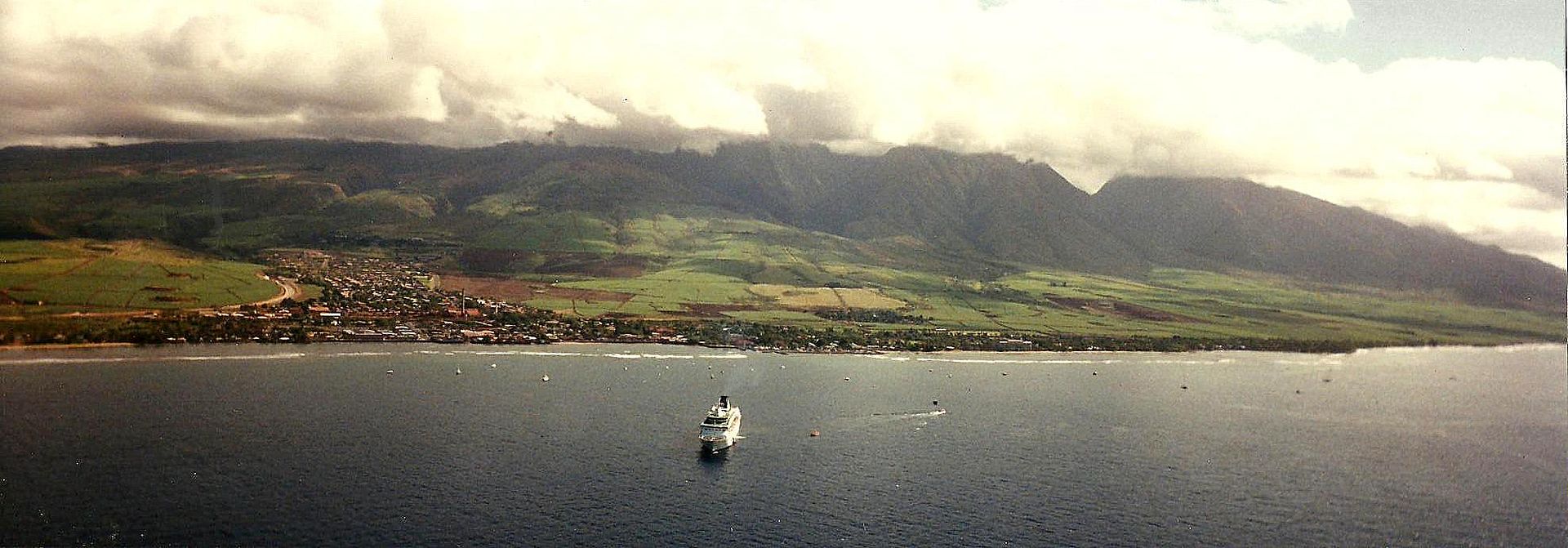
This is passing Maui on our way to the big Island...roughly 1988. It was very common to see pods of humpback whales breaching as well as very large sea turtles.
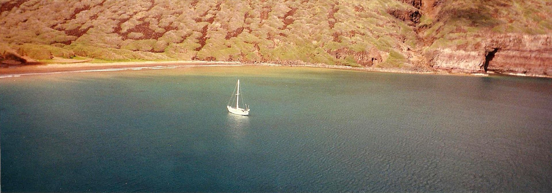
This is an island just off Ni'ihau. This is at the top of the Hawaiian chain and one of the islands that is actually privately owned. This lucky boater has the cove all to himself...paradise!
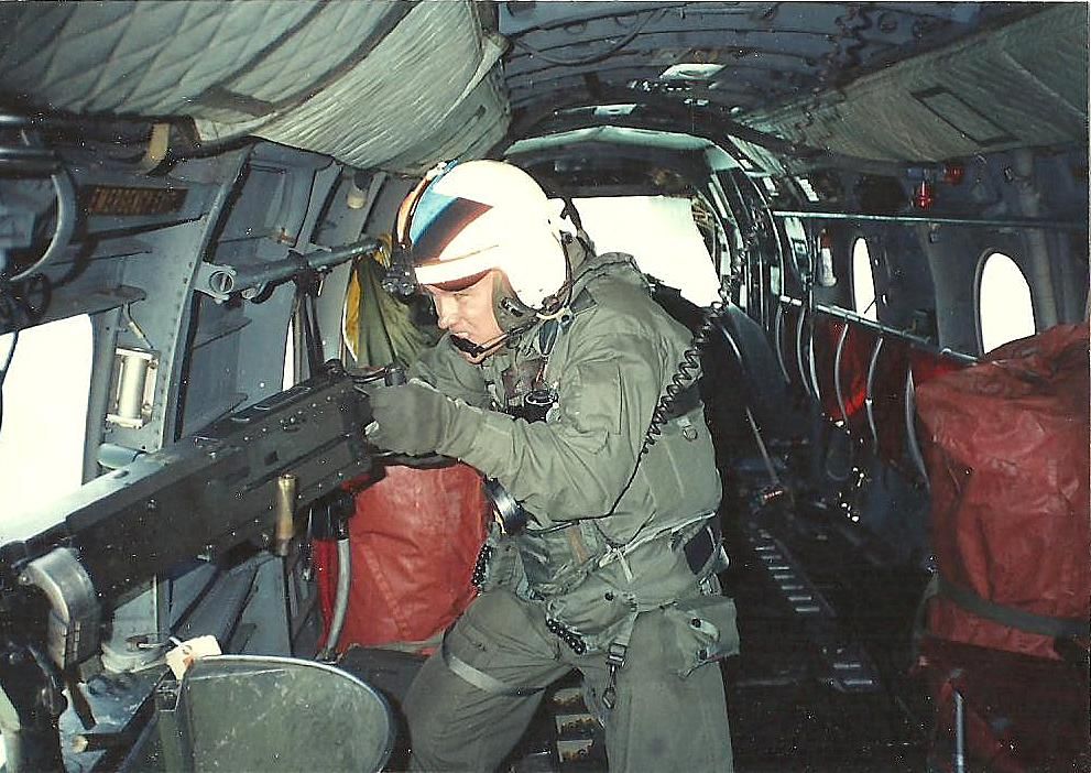
The above photo was taken on our way to a range area. Here is an actual photo of me at that range....approximately 25 years ago..:lol: Look closely...its an action shot!
Now we head to Okinawa Japan around 1989 roughly. The water is just as blue as Hawaii...but shallow in many areas.
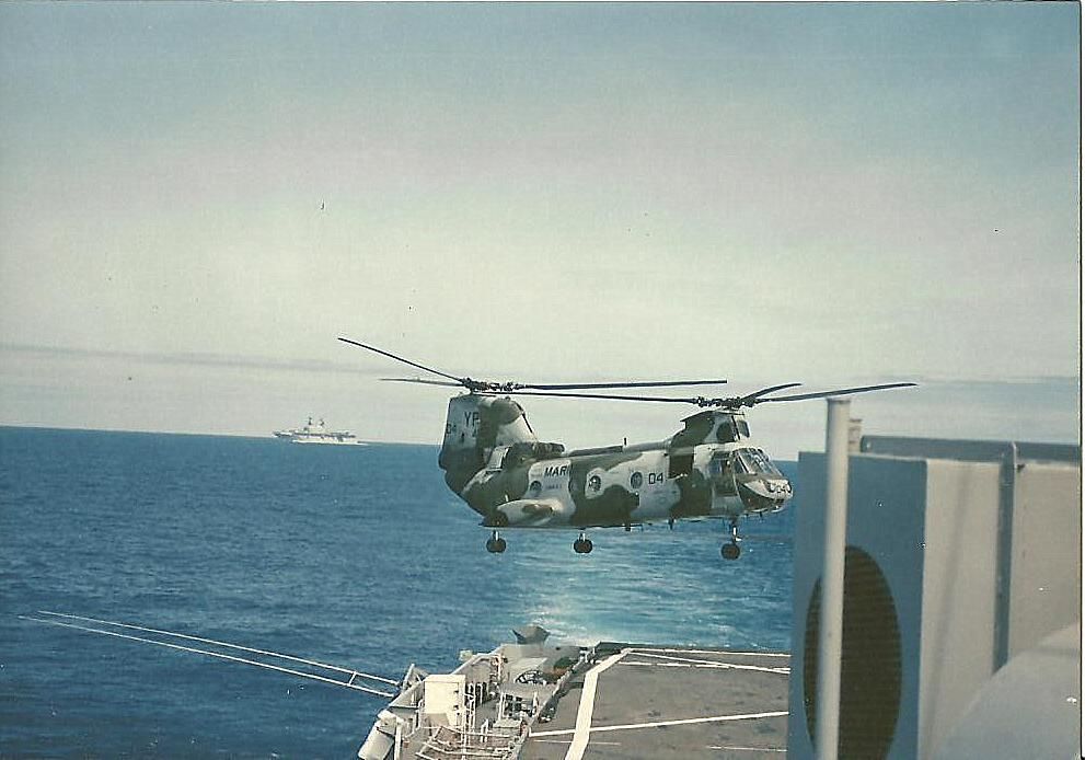
After being in Oki we catch a ride on the USS Dubuque (LPD-8 ) and head south to the Phillipines. It was very calm there arriving on the boat in Oki......but so rough off the coast of PI that the pitching and rolling of the deck exceeded our ability to take off. I think it was 3-4 days travel by boat.
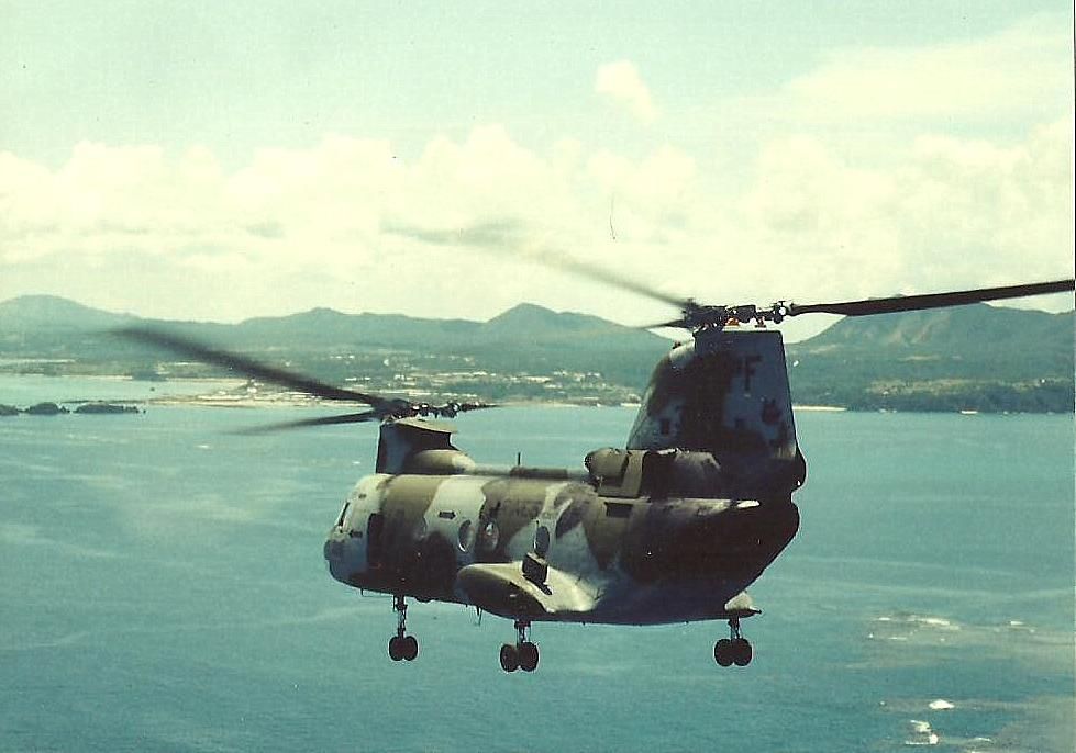
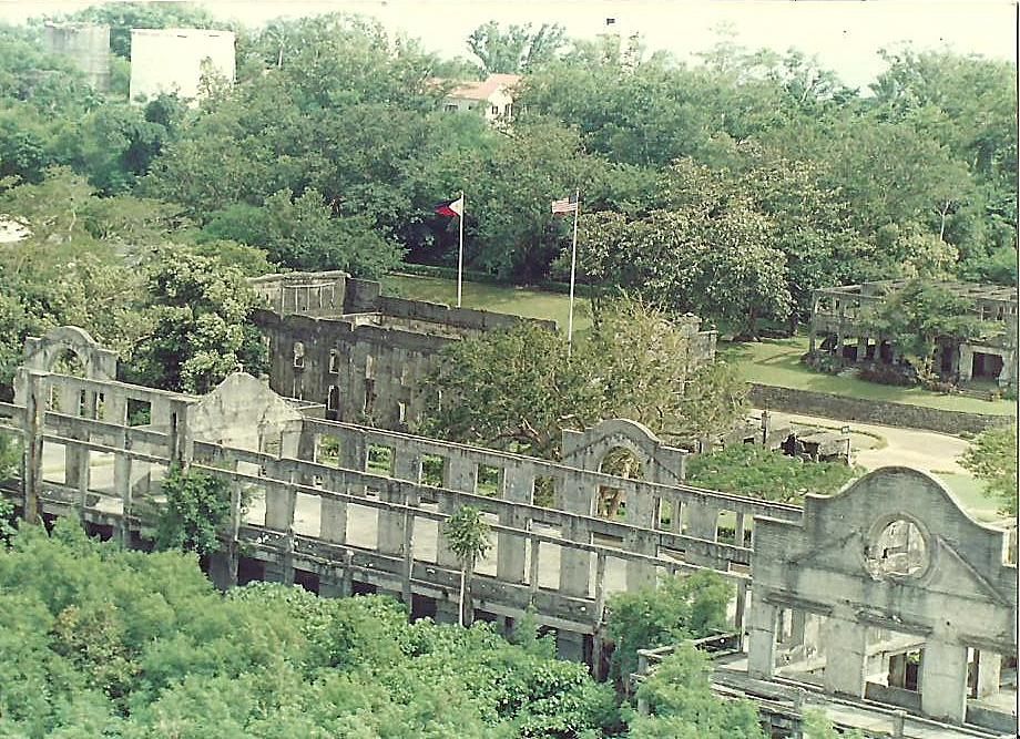
Taking off from the US Dubuque and passing Corregidor Island at the mouth of Manilla bay in the Phillipines on our way to Cubi Point/Subic Bay. Severe WWII battles were fought here. Many Americans and Filipinos died.
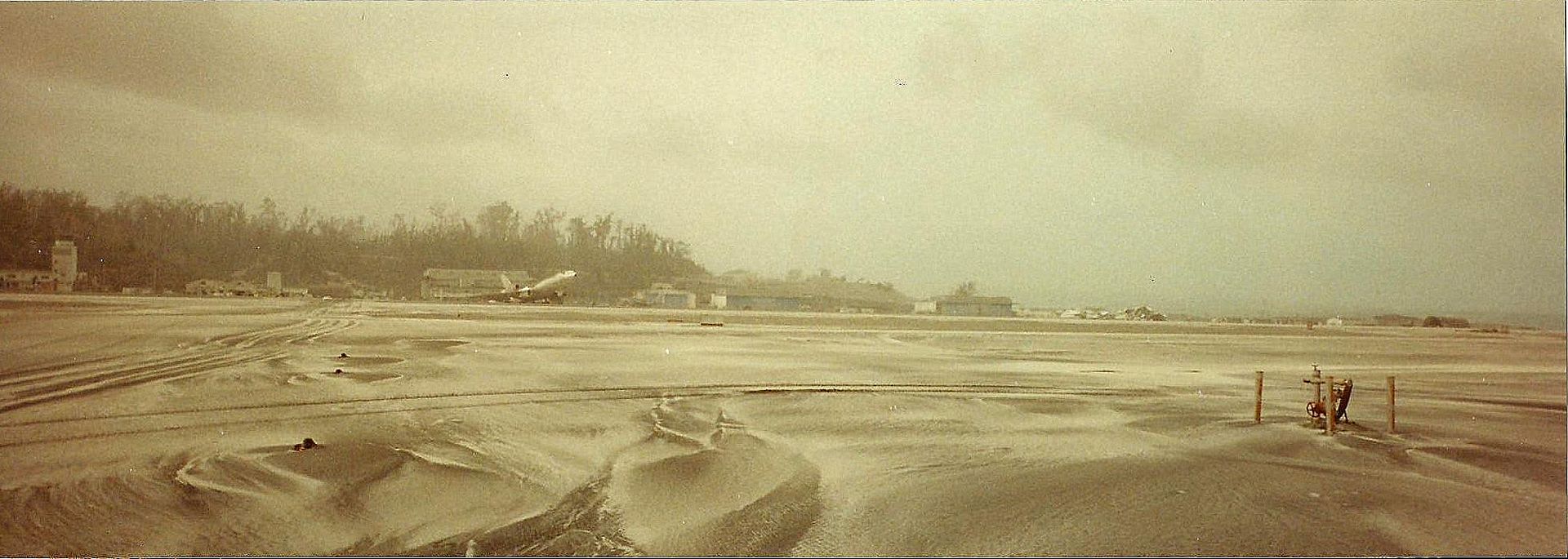
Roughly 1991 Mt Pinatubo erupted into one of the largest eruption since that of Novarupta in 1912 and some ten times larger than the 1980 eruption of Mount St. Helens. This is the runway at Cubi Point. Notice the L1011 that got caught in the eruption. Its sitting on its tail because there is so much volcanic ash on its tail.
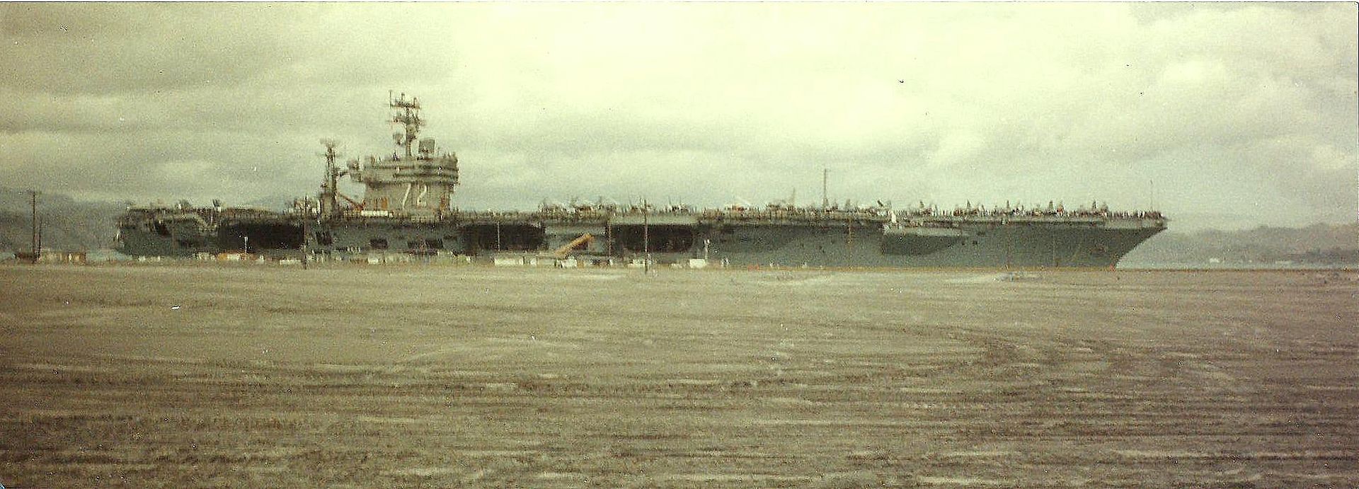
This is the USS Abraham Lincoln pulling in right in front of our hangar to render assistance.
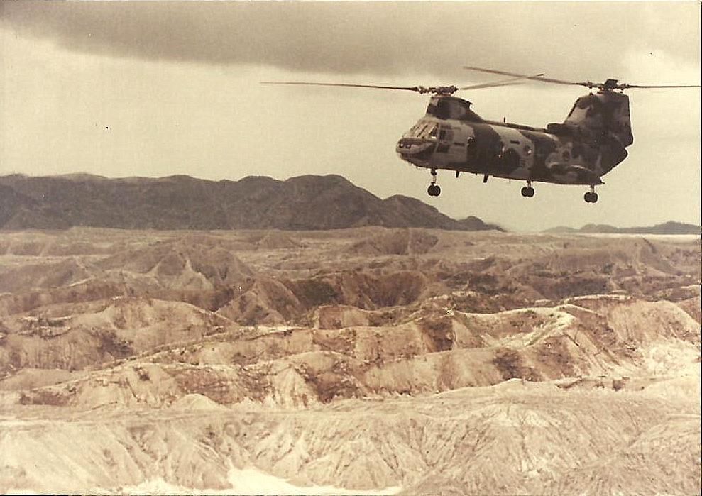
The place was devastated. Since our hangar was one of the only ones not destroyed..we ran missions to Clark AFB to recover classified munitions. Clark was completely destroyed...never to be an active base again. Some of the villagers who lived in huts were covered by hundreds of feet of ash. In this pic....there used to be deep valleys of lush green jungle.
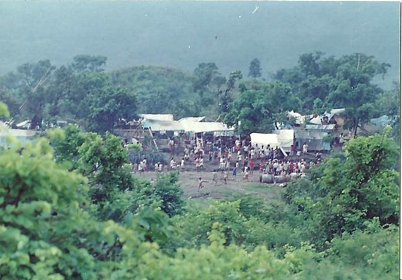
Taking food and supplies to the displaced Filipinos. It was a madhouse. We ended up having to hover and kick out the food.
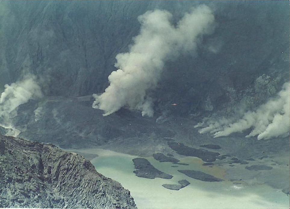
About 7 or 8 days after the volcano erupted and devastated the Island...they needed volunteers to take some vulcanologists to Mt Pinatubo to survey the area and take air samples. These are the first pics to be taken after Pinatubos eruption that I am aware of. This is the inside of the crater. There was no crater prior.
This was the flightline in Oahu at Kaneohe bay. It was an absolutely beautiful place to work everyday.
This is passing Maui on our way to the big Island...roughly 1988. It was very common to see pods of humpback whales breaching as well as very large sea turtles.
This is an island just off Ni'ihau. This is at the top of the Hawaiian chain and one of the islands that is actually privately owned. This lucky boater has the cove all to himself...paradise!
The above photo was taken on our way to a range area. Here is an actual photo of me at that range....approximately 25 years ago..:lol: Look closely...its an action shot!
Now we head to Okinawa Japan around 1989 roughly. The water is just as blue as Hawaii...but shallow in many areas.
After being in Oki we catch a ride on the USS Dubuque (LPD-8 ) and head south to the Phillipines. It was very calm there arriving on the boat in Oki......but so rough off the coast of PI that the pitching and rolling of the deck exceeded our ability to take off. I think it was 3-4 days travel by boat.
Taking off from the US Dubuque and passing Corregidor Island at the mouth of Manilla bay in the Phillipines on our way to Cubi Point/Subic Bay. Severe WWII battles were fought here. Many Americans and Filipinos died.
Roughly 1991 Mt Pinatubo erupted into one of the largest eruption since that of Novarupta in 1912 and some ten times larger than the 1980 eruption of Mount St. Helens. This is the runway at Cubi Point. Notice the L1011 that got caught in the eruption. Its sitting on its tail because there is so much volcanic ash on its tail.
This is the USS Abraham Lincoln pulling in right in front of our hangar to render assistance.
The place was devastated. Since our hangar was one of the only ones not destroyed..we ran missions to Clark AFB to recover classified munitions. Clark was completely destroyed...never to be an active base again. Some of the villagers who lived in huts were covered by hundreds of feet of ash. In this pic....there used to be deep valleys of lush green jungle.
Taking food and supplies to the displaced Filipinos. It was a madhouse. We ended up having to hover and kick out the food.
About 7 or 8 days after the volcano erupted and devastated the Island...they needed volunteers to take some vulcanologists to Mt Pinatubo to survey the area and take air samples. These are the first pics to be taken after Pinatubos eruption that I am aware of. This is the inside of the crater. There was no crater prior.