


Germany Minimum Vectoring Altitude Chart

Thread Starter
Germany Minimum Vectoring Altitude Chart
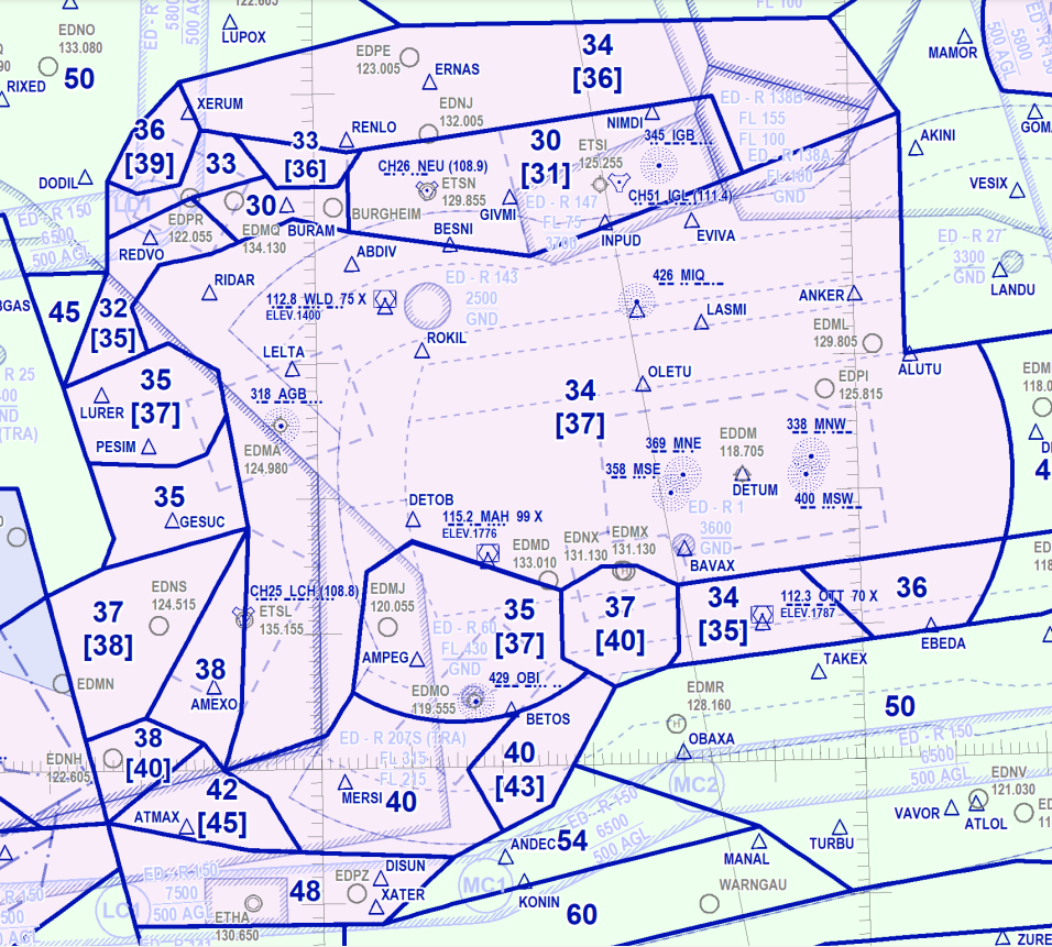
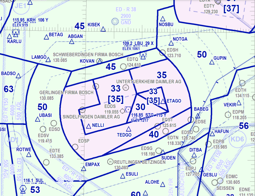
Hi All! I am looking for some info regarding MRVA for EDDS-STR and EDDM-MUC aerodromes. My company's chart provider does not publish any so I checked German AIP and found that one:
https://aip.dfs.de/BasicIFR/pages/P00DD0.html
However, the resolution of the image is low and I can't read any details. Does anyone have a better chart maybe? Appreciate your help.
https://aip.dfs.de/BasicIFR/pages/P00DD0.html
However, the resolution of the image is low and I can't read any details. Does anyone have a better chart maybe? Appreciate your help.

In the UK, charts are published for every individual IFR airfield and included in the individual AIP entries rather than a single general one; doesn't Germany have anything like that?
Called 'Surveillance Minimum Altitude Charts' (SMAC)
Called 'Surveillance Minimum Altitude Charts' (SMAC)

Thread Starter
indeed they are charts for airports but without any MRVA info

Thread Starter

Join Date: Feb 2016
Location: Location Location: Location
Age: 30
Posts: 23
Received 0 Likes
on
0 Posts
https://aip.dfs.de/basicIFR/print/EN...titude%20Chart
use the + button to then zoom in, it gets really clear.
use the + button to then zoom in, it gets really clear.
Spoiler
Spoiler
Last edited by therocketscientist; 23rd Apr 2023 at 11:57. Reason: added screenshots
Thread Starter
https://aip.dfs.de/basicIFR/print/EN...titude%20Chart
use the + button to then zoom in, it gets really clear.
use the + button to then zoom in, it gets really clear.
Spoiler
Spoiler
